Penguin Pictures! Penguin Pictures!

untitled-9135.JPG

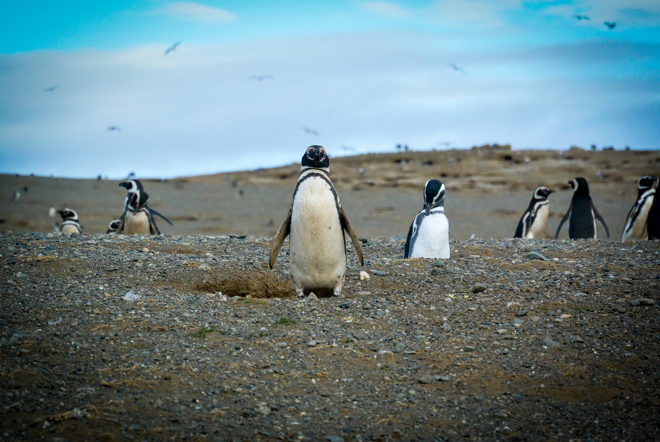
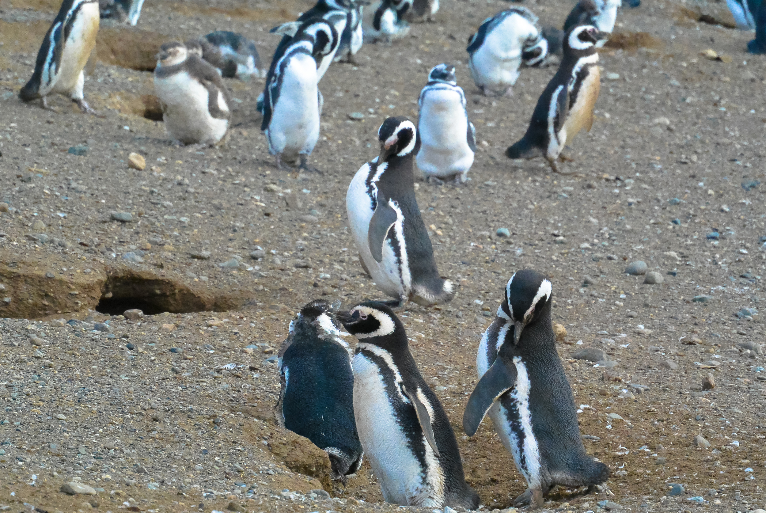
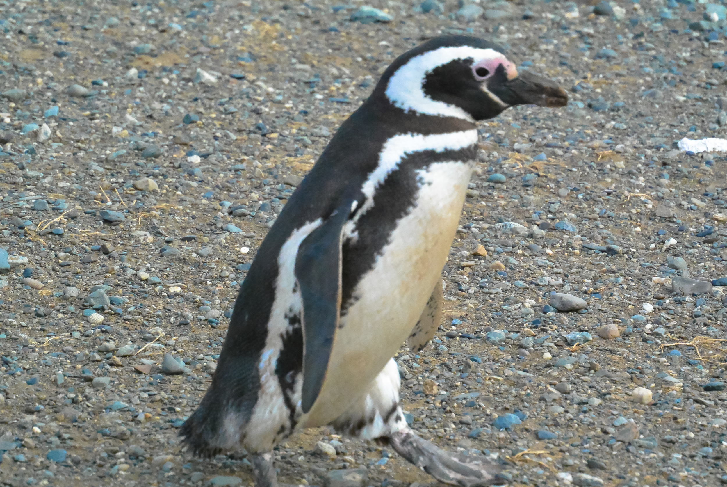
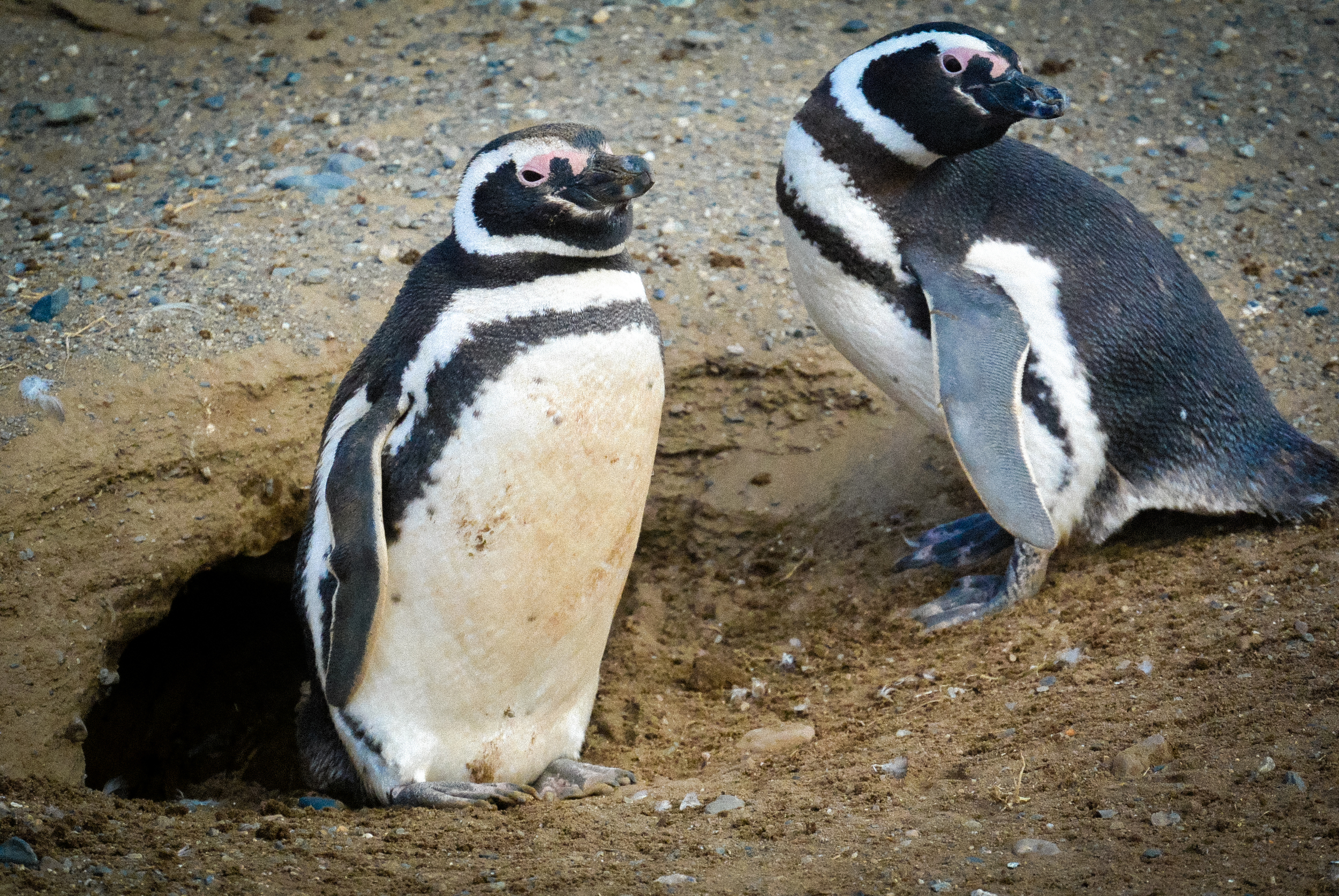
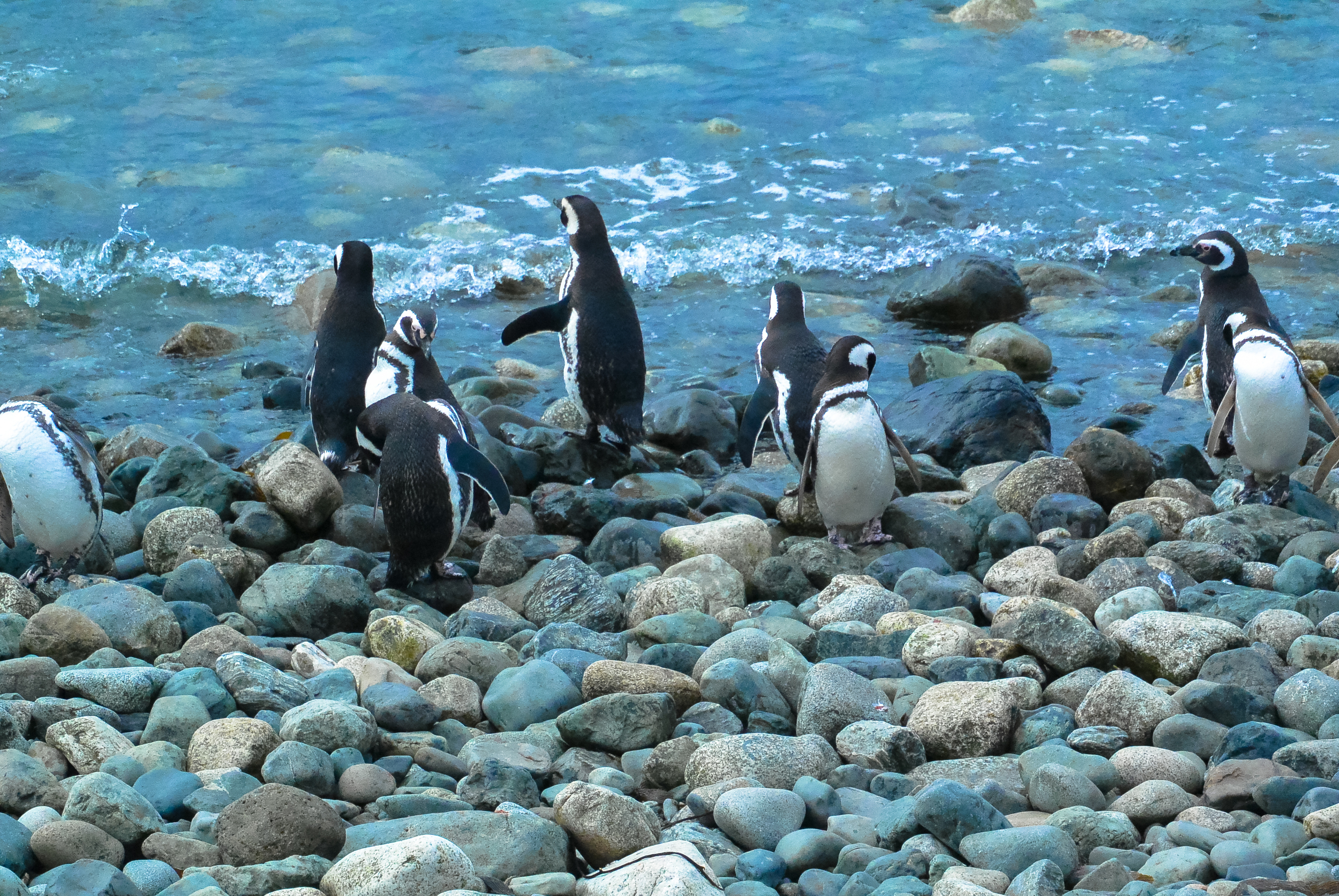
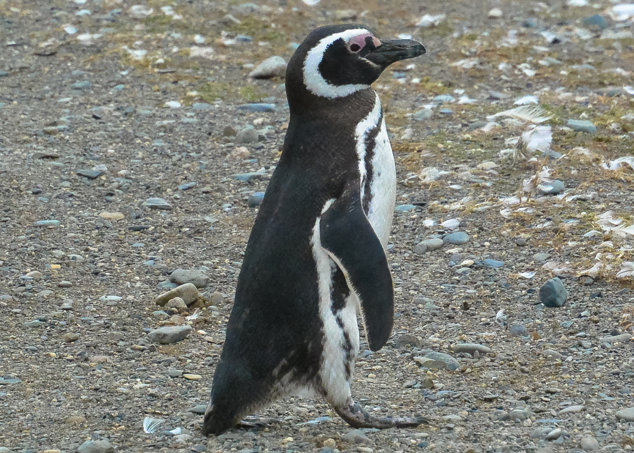
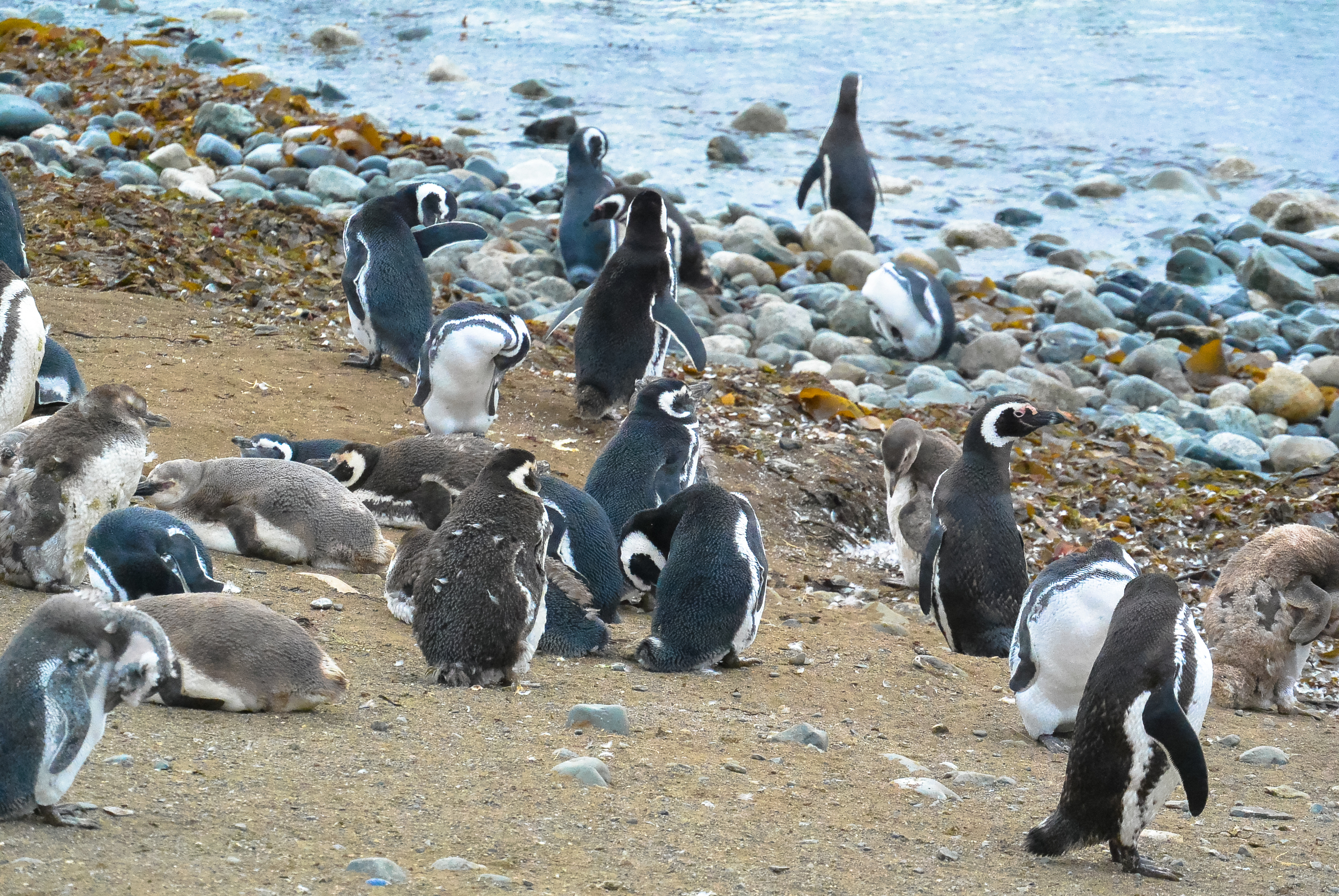
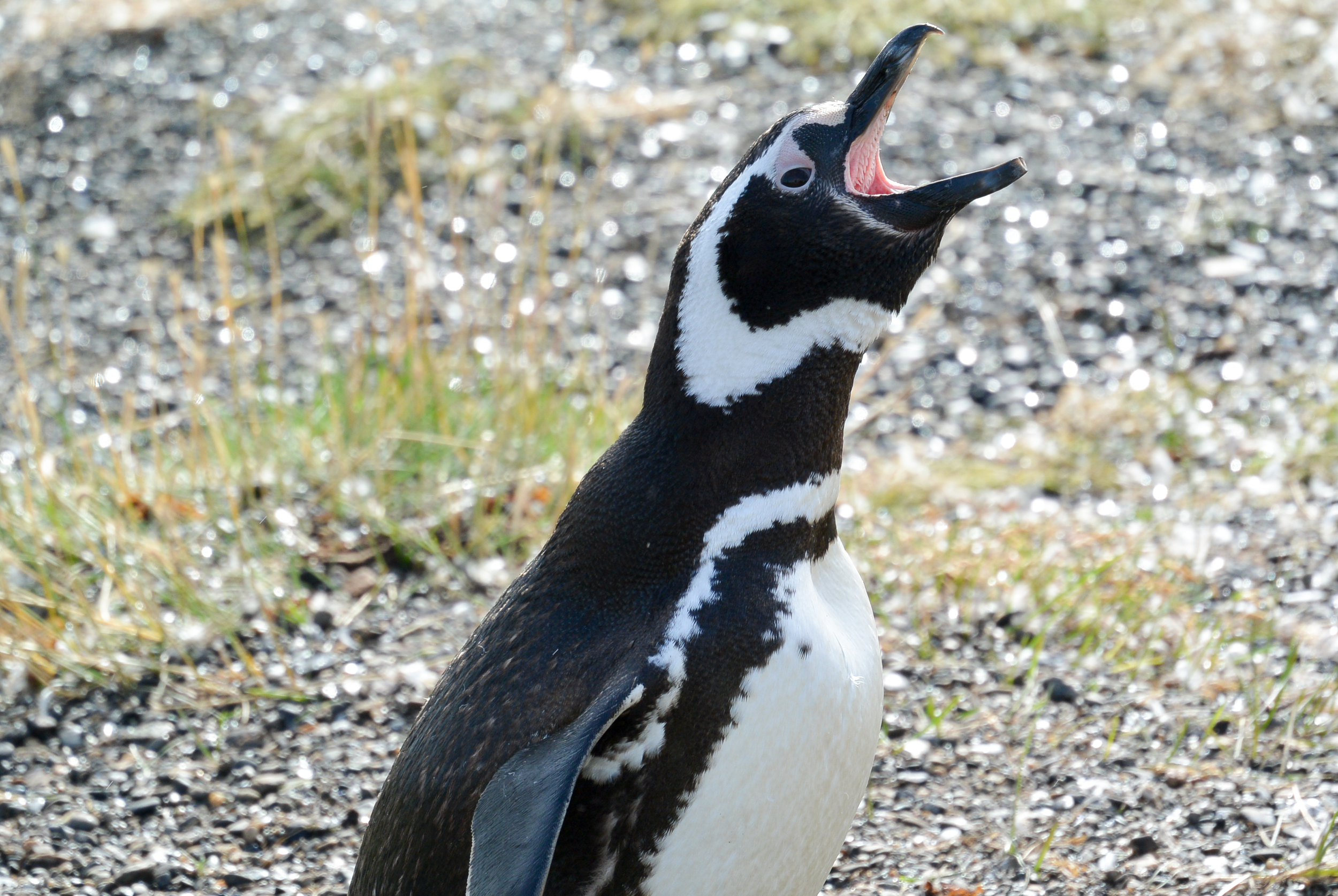
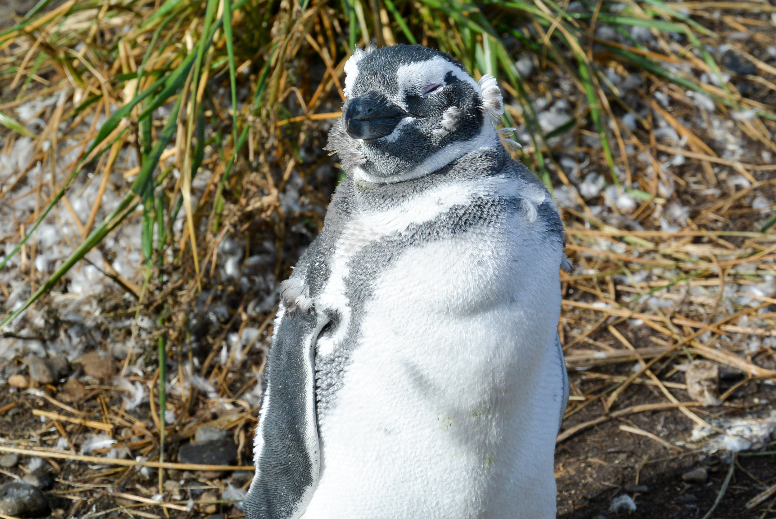
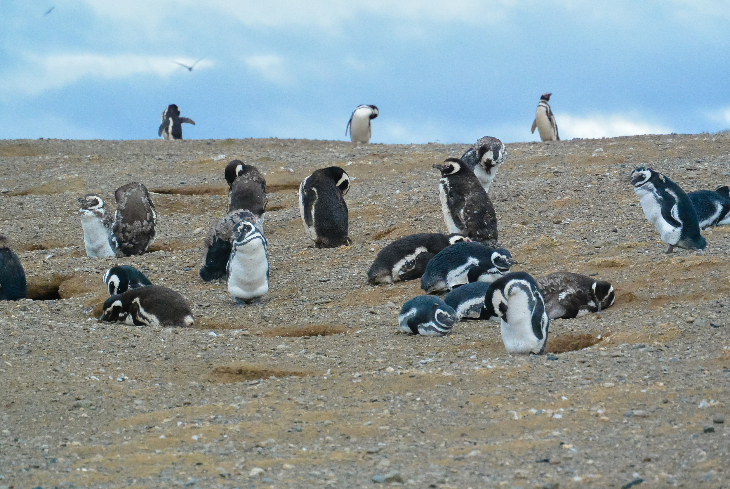
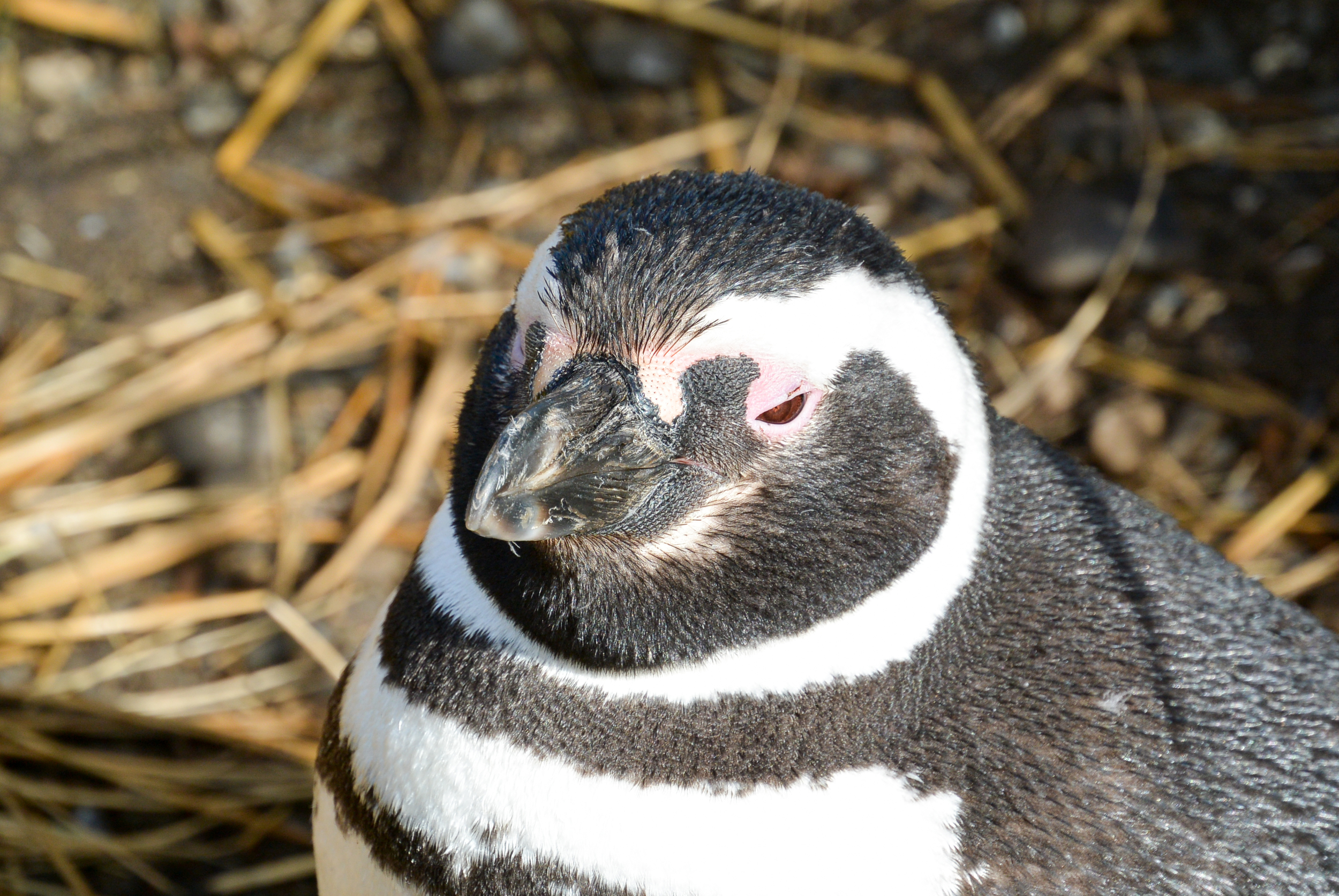
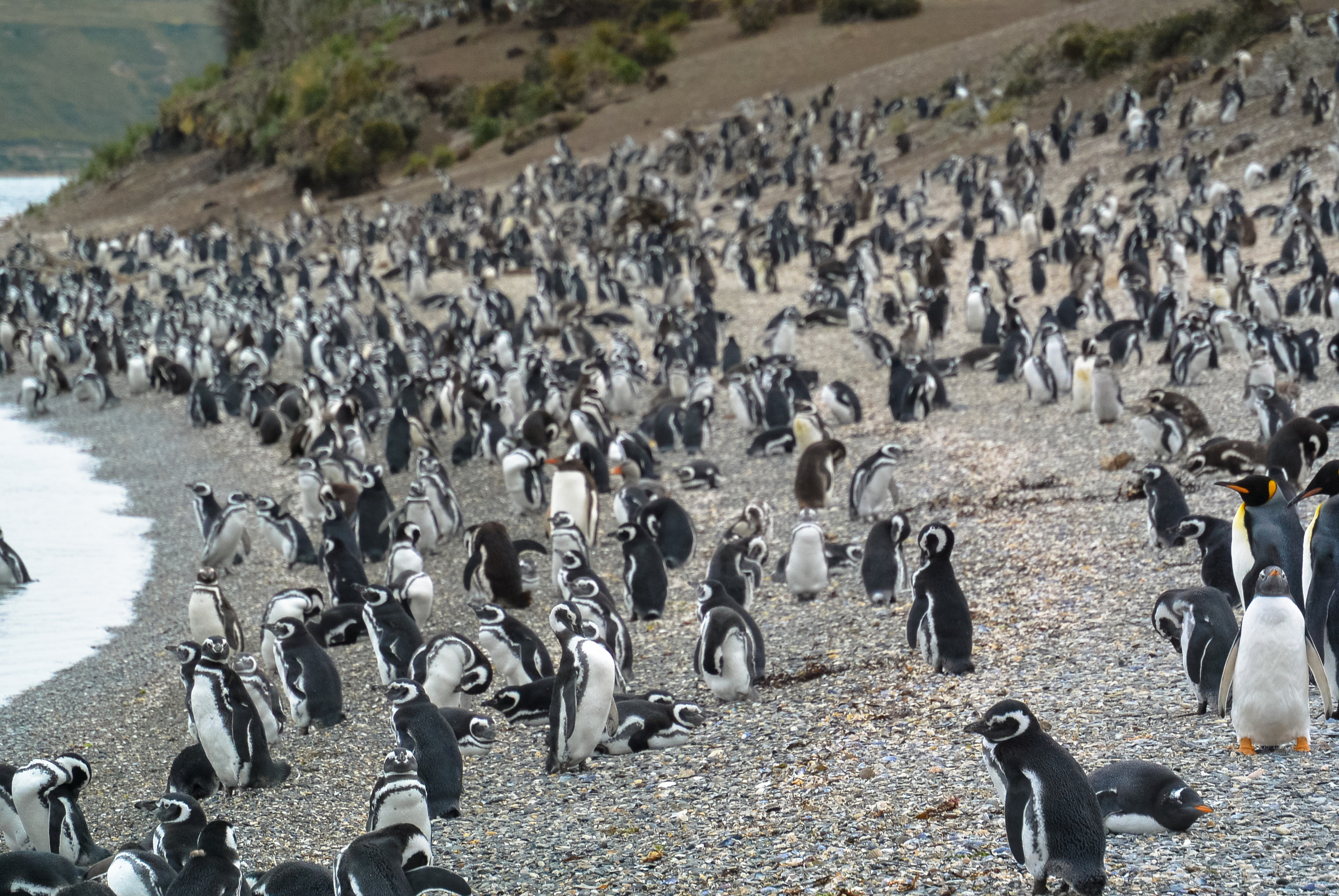
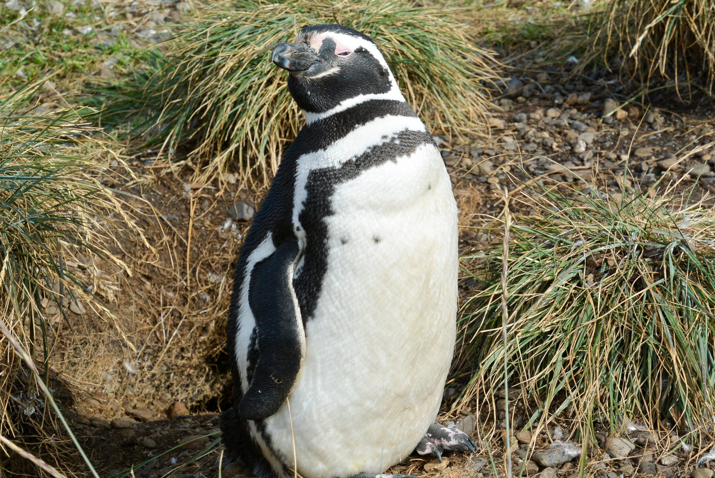
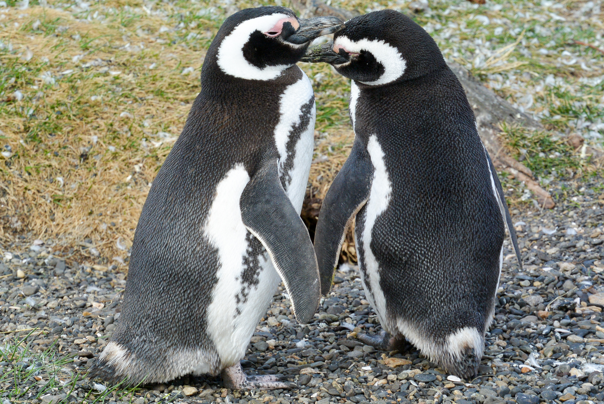
Well hello! A week and change later I'm back in DC after my amazing trip to Patagonia, and it is now time to share some more photos, including the highly anticipated photos from my visits to three penguin colonies.  While in Punta Arenas, Chile I visited the Seno Otway and the Monumento Natural los Pingüinos. At both of these colonies, I saw hundreds, if not thousands of Magellanic Penguin who were nested at the colonies for the summer mating season. Yes, that meant there were baby penguins.

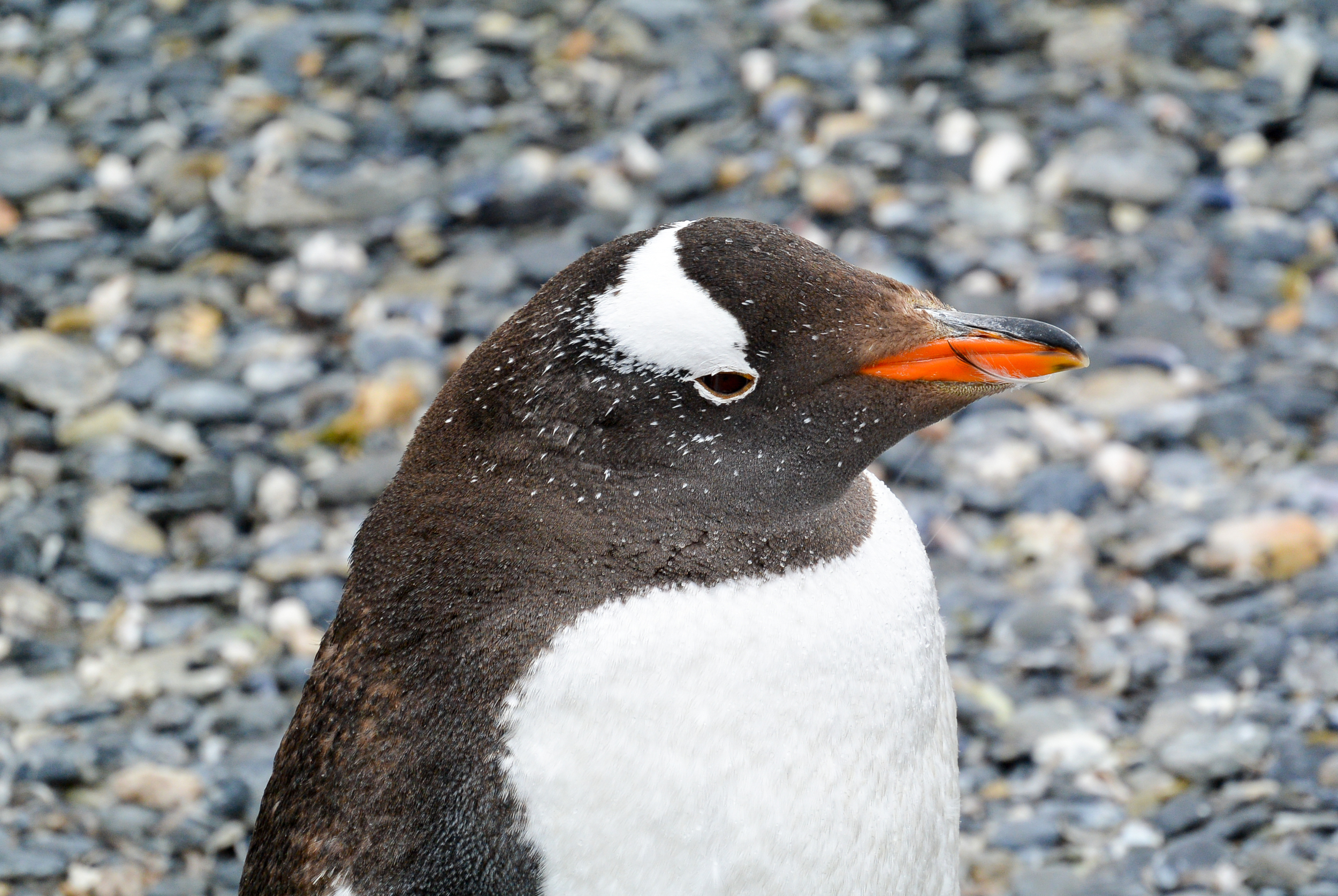
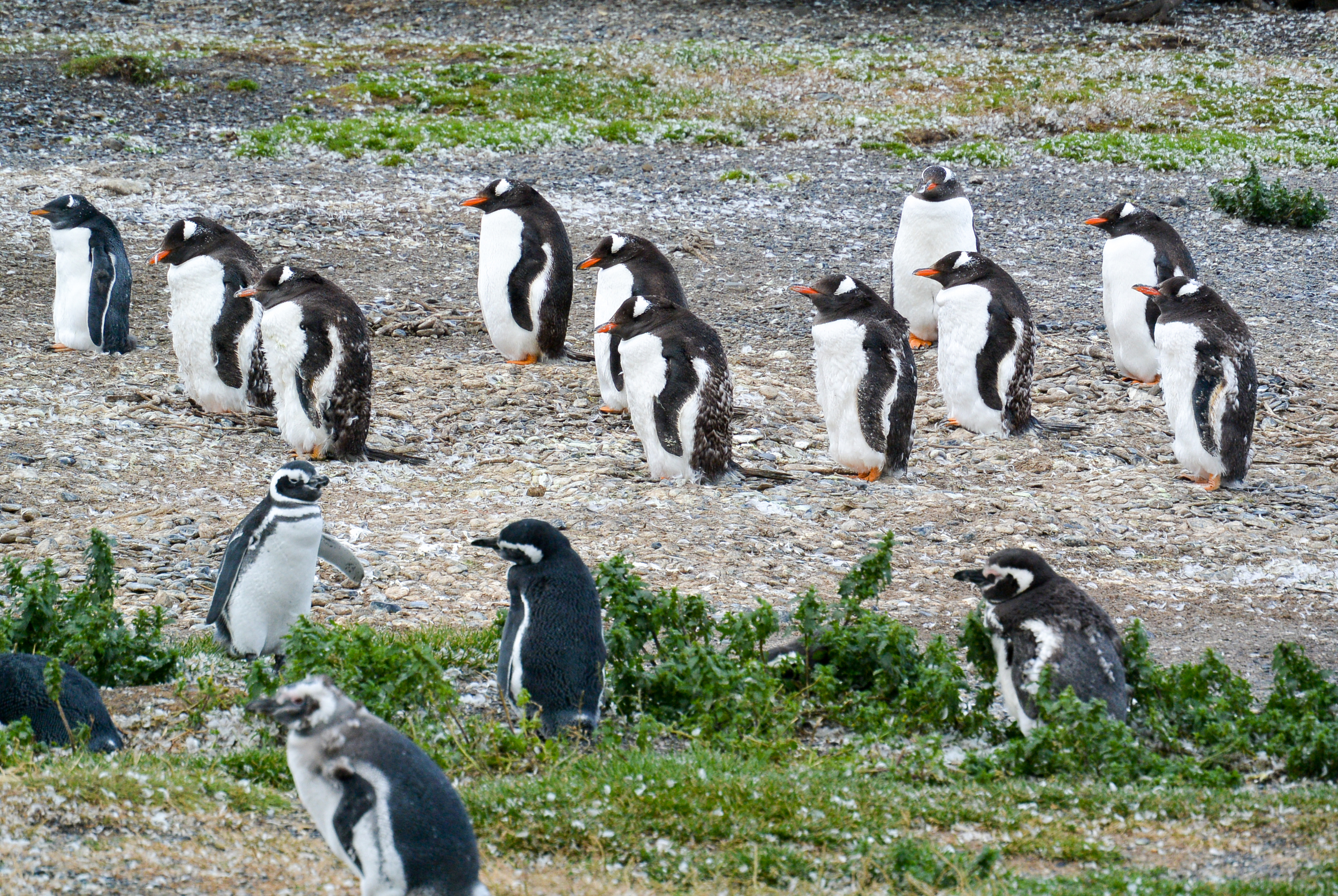
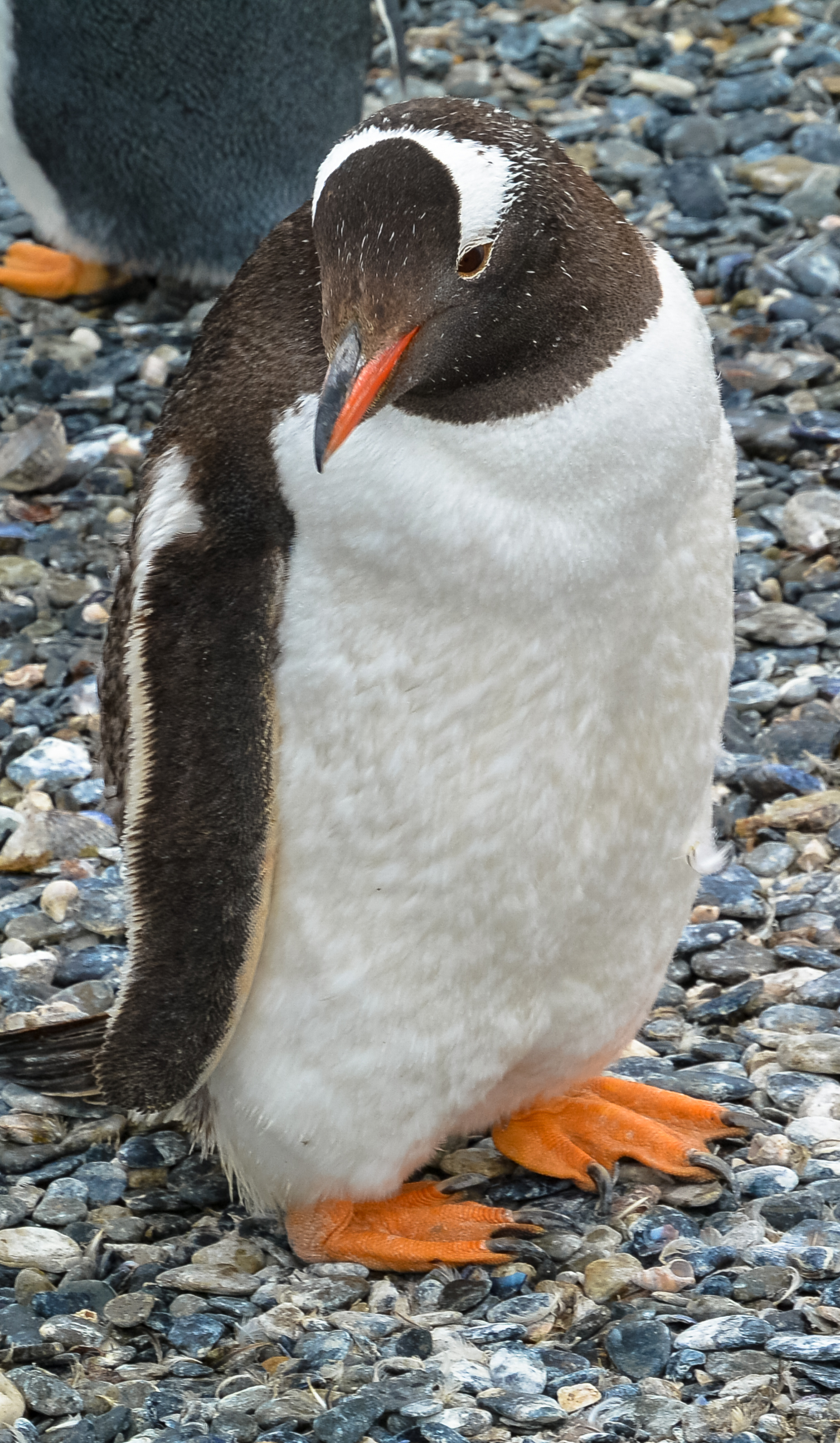
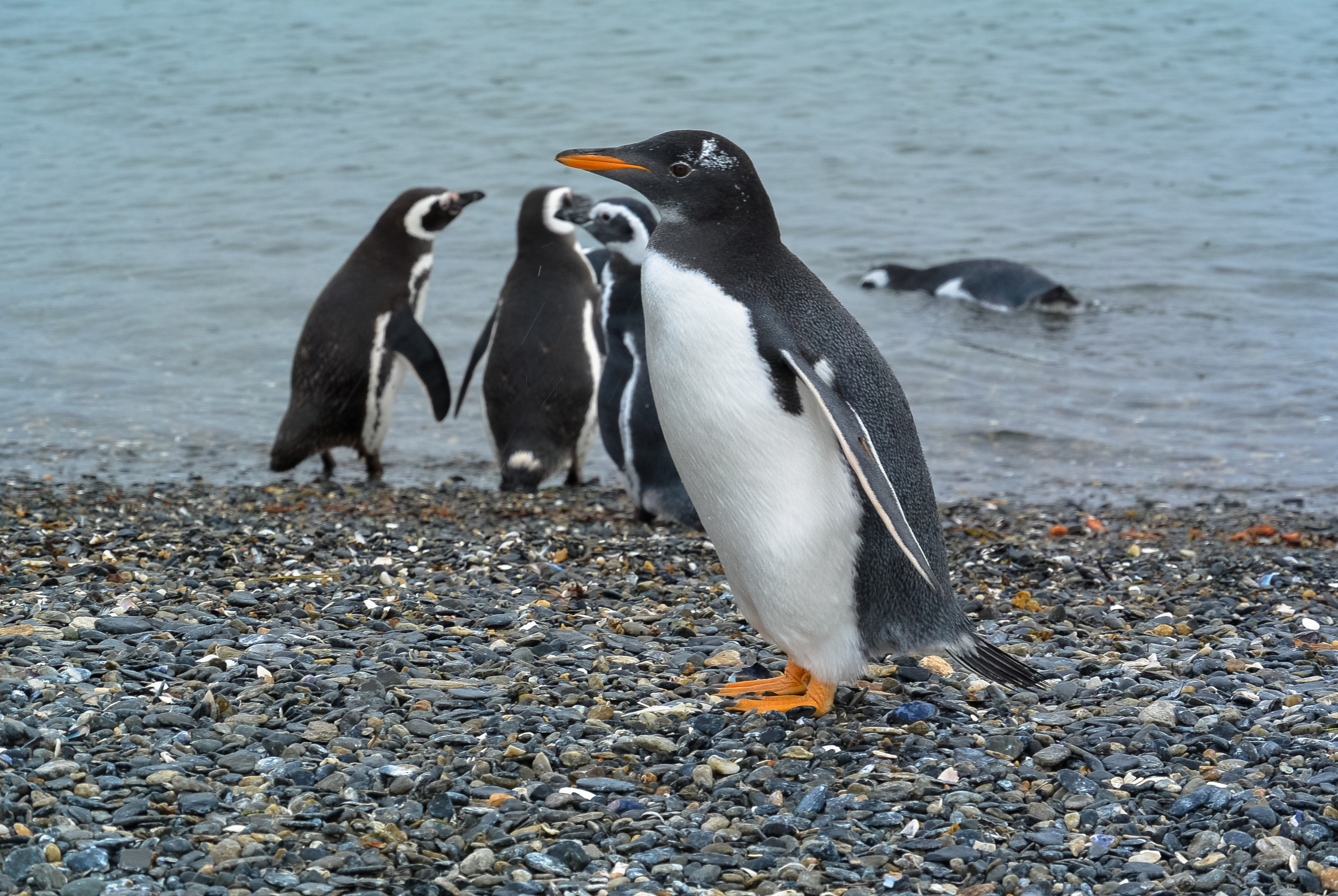
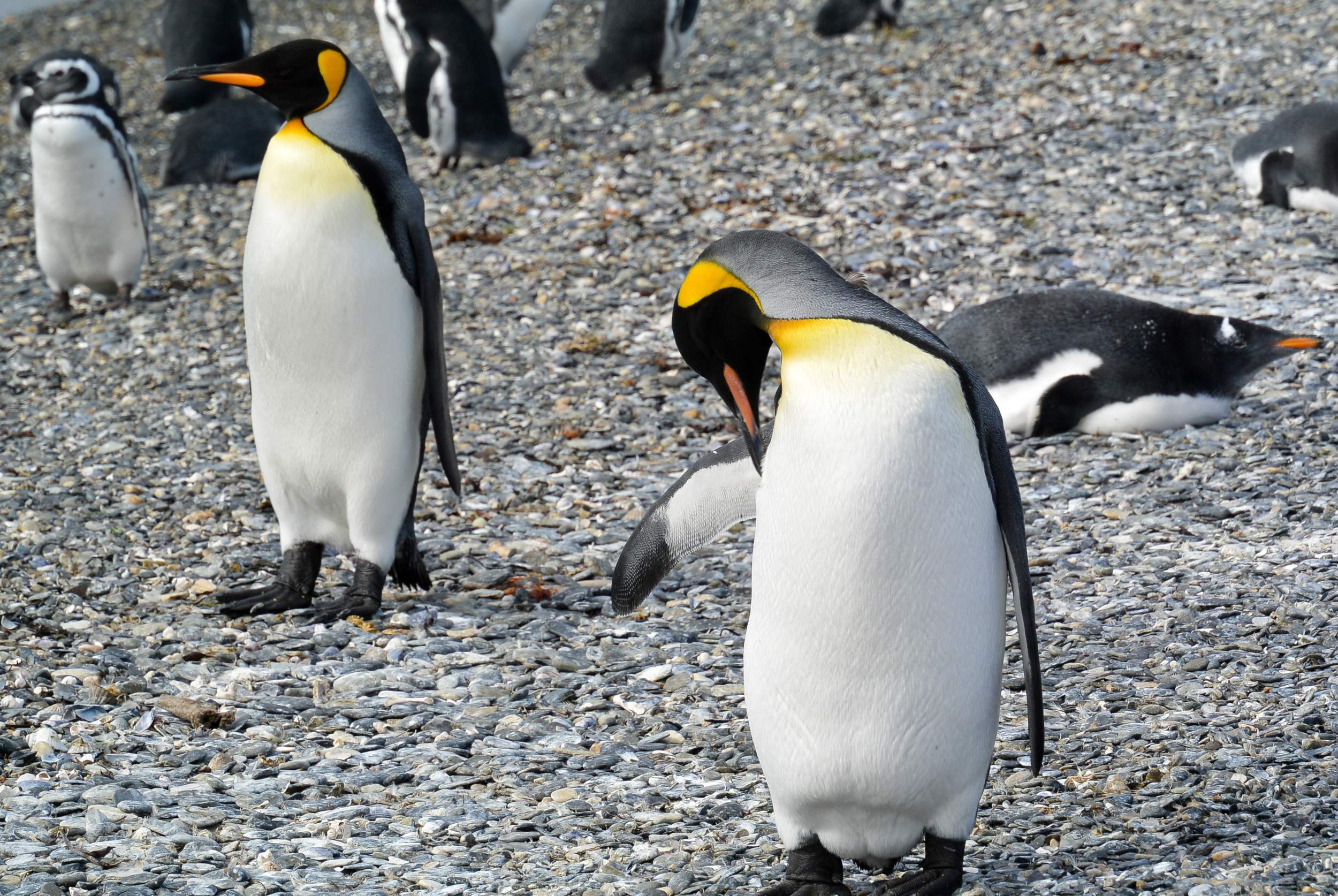
In Ushuaia, Argentina I visited the colony located on Isla Martillo. At this colony I saw Magellanic Penguins as well as both Gentoo Penguins and breeding pair of King Penguins, which are the second largest species of penguin in the world. They are quite large!

Overall it was amazing to see these penguins in the wild, watching them swim, build nests, and stand at attention over their eggs. I was able at all the colonies to get extremely close to the penguins, so close that the photos I took are more amazing than I even expected them to be! Below is a sample of some of the photos I took of penguins during my trip. You can also view the full gallery in the Penguin Photos Gallery under MattPhotos.  Enjoy!


A post of Glacial Proportions

image.jpg

Hello from Los Glaciares National Park, home to the Perito Moreno Glacier. This national park, located on the border of Chile, is home to several famous glaciers, including the afformentioned Perito Moreno. 

Crossing the steppe to El Calafate.  

Crossing the steppe to El Calafate.  

I arrived back into Argentina yesterday afternoon from Chile to the city of El Calafate, located on the high arid steppe of Patagonia. This means that typically it never really rains in El Calafate (the average precipitation here is akin to San Diego); however it sure did yesterday afternoon and night.

Downtown El Calafate, the town a glacier built. it's actually named for a type of blueberry. 

Downtown El Calafate, the town a glacier built. it's actually named for a type of blueberry. 

The town somewhat of a boom town in that the infrastructure here has really only come into existence in the past 10 years. While this means that everything is more expensive than it needs to be, it also means that getting to see the glaciers was extremely easy today. It helps that Argentina's current president comes from here and has significant ties to the tourism industry here.  

We began the day early, heading out approximately 25 kilometers from the town, and passed through more arid steppe until we reached the Magelenic Forest as we approached the Andes. The land became greener, and after a short while the Perito Moreno Glacier came into view. 

image.jpg

After entering the park (which costs more than a movie in Manhattan, but whatever) we immediate bordered a boat, crossing Lago Argentina to reach the south face of the glacier where I was confronted with a sheer wall of blue and white ice, over 60 meters high, nearly 14 kilometers long, and at its widest point 5 kilometers wide! All the while, thunder like sounds echoed through the lake as pieces big and small of ice broke off the main glacier, falling spectacularly into the wintergreen blue colored lake below. 

image.jpg
image.jpg
image.jpg

While I thought the boat ride would be the highlight of the day, the real treat came when I was able to hike alongside the glacier! When the glacier formed, it covered an entire corner and branch of the lake.  As it melted, a narrow channel formed between the glacier on one side and a hill opposite it. The national park contains a series of walkways (catwalk like pathways of stairs and ramps) that allow you to get as close to the glacier as possible. This allowed for more amazing photo opportunities as well as for viewing and hearing more thunderous ice shearing off the glacier's face. 

Overall this was an amazing experience and a great reason to take the northern detour to El Calafate on my way to Ushuaia. While I could do without the extreme tourism (everything is so much more expensive here than on the rest of my trip has been and they are probably more try to take your photo for money people here than on Main Street, USA), the glacier is something not to be missed! Expect a bigger album of photos from the glacier when I arrive home after my trip. Next stop, the End of the Earth!! 

Puerto Natales and Torres del Pines

image.jpg

Greetings from Puerto Natales, Chile! This small town located 250 kilometers from Punta Arenas is located on a fjord of the Pacifc Ocean. It reminds me a lot of Seaside, Oregon or really any of the towns I've been to in the Pacific Northwest coast. Even down to the earthquake and tsunami warning signs. I guess we could call it the Pacific Southwest?

It's been an amazing couple of days traveling across Chilean Patagonia. I've seen penguins and penguins, glaciers, mountains that scrape the sky and are covered in snow, and a whole bunch of other amazing sights too difficult to explain with words. I've also learned that outside of eating, visiting Chile for fun means you're charged for hotels, etc. tax free and in good old U.S. Dollars. Freedom isn't free, but I enjoy using my $1.25 to pay for it in this country. I also experienced a nine hour delay getting from Puerto Montt to Punta Arenas thanks to engine problems on the plane. They did however compensate me for my time, and I was actually able to sleep in the airport, so the next day in Punta Arenas wasn't a total loss.

While I'll focus on penguins in Punta Arenas in a separate post, in this post I wanted to talk about what I did today, a whirlwind ten-hour tour of the Torres de Paines National Park. We covered a lot of ground in that time, but the trip was amazing. There's been several times in my life I've thought to myself I'm visiting something special, something unique and singular. This was one of those days. 

image.jpg

We began the day with a whole lot of geology and visited Milodon Cave.  This cave, known primarily for the location of the discovery of a prehistoric giant bear like sloth, named the milodon, was formed through the erosion of a mountain by a prehistoric lake. The lake eroded the "soft" rock between two hard rock parts, forming a wide yet somewhat shallow cave. As an aside, the fossils found in the cave however have made their way to two museums I've been, however, the Royal Natural History museum in London and my all time favorite museum — the greatest museum in the world, home of the Big Blue Whale in the Hall of Oceans, and the best dinosaur fossils ever— the American Natural History Museum in New York.

​After our visit, we headed northwest, hugging the Argentine border on Route 9, known as the Road at the End of the World, passing through the arid, flat, and empty plains that make up the interior of Patagonia

When we arrived, we were immediately greated with a beautiful view of the Torres de Paine. These three jagged rock formations soar into the sky from nearly sea level alongside snowcovered mountains to form the park's iconic image in front of a blue-green lake. The weather behaved well today, as if it had been a bit cloudier our view of them would have been obstructed. Although in Patagonia, wait five minutes and the season changes.

We then ventured further into the park, driving on unpaved and narrow roads, all the while surrounded by amazing landscapes. After a short while, we came to a stop on the road. Our guide pointed out a flock of condors sitting on a easily reachable hill only a few hundred yards away. We all got out of the van, cameras in hand, and walked up to the top of a hill to view the condors up close. What I witnessed was truly magical. Seven or eight condors first resting, then soaring above, below (down in the valley on the other side of the hill) and around us! They were so close I snapped some amazing photos of them using my "real" camera. I'll post these when I return home. 

We also had close up encounters with several guanaco, an animal that looks sort of like a cross between a camel and a llama, and ostriches. 

After going further along the park we stopped at the Salto Grande waterfall. This waterfall, formed as the glaciers receded, links two lakes in the park at different elevations, and has the characteristic wintergreen color caused by sediment from glaciers. It was pretty amazing and provided many opportunities for photos as well as a gorgeous foreground for more photos of the landscape. 

More from Salto Grande.  

More from Salto Grande.  

After a stop for lunch (a grilled steak meal was included in this tour's cost) we headed for the Grey Lake and the Grey Glacier. This glacier, which was unfortunately 17 kilometers away from us at the other end of this massive glacial lake, yields amazing ice flows and icebergs that when viewed appear to be blue in color. Additionally to reach the lake required a hike through the forest and over a fast moving river bring glacial melt through the park and eventually out into the Pacific Ocean. I wish we could have spent more time here and take the boat ride to the glacier itself, but that will come on Saturday, in Argentina,  when I visit the Perito Moreno Glacier. Gelogically, they are part of the same formation. 

Overall this tour was excellent and provided me with amazing photo opportunities and viewing of amazing landscapes and wildlife. I think that if I were to come to the park again (and I would love to do so one day) I might make it my primary destination and do much more hiking and maybe even stay overnight at one of the lodges located there. Maybe in 9 years...I feel like that could be a good future I don't want to think about that birthday trip.

Crossing the Andes with Matthew

I crossed the Andes! And it was less difficult than in  The Mission. Look it up, great film. Also today was one of those days I wish I was a geoscientist, although readers out there who are, you're in for a treat! My journey was on the Cruce Andino, a route that combines bus and boat travel across the Andes to Chile from Argentina. 

On board boat number one heading west towards The Andes and Chile.  

On board boat number one heading west towards The Andes and Chile.  

We started out day very early in Bariloche. After a short bus ride to Puerto Pañuelo, we boarded a fast catamaran to cross Lake Nahuel Huapi. During the crossing the Andes grew closer and closer as we went further west. The water became greener, changing from the dark blue color at the shores of Bariloche. 

The change in color of the water was quite dramatic, happening almost instantly.  

The change in color of the water was quite dramatic, happening almost instantly.  

After reaching Puerto Blest, we boarded a bus for a short portage (I'm literally using that word right here) to the banks of the Lago Frías (which if you remember from yesterday has a milky wintergreen appearance because of the sediment in the glacial runoff from the black glacier). On arrival we boarded a boat to cross the lake and arrived at us the Argentine Border. At this point we were 700 meters above sea level (and at this point the sea in question was still the Atlantic). 

Boat number two across Lago Frías.  

Boat number two across Lago Frías.  

Getting closer to Chile.  

Getting closer to Chile.  

After a somewhat confusing process to get out of Argentina (seriously I want to work on the translations they say on this tour into English for them sometimes), we boarded what amounted to a off road bus and climed into the Andes and towards the Chilean border. After what looked like a segment of driving from a Top Gear Christmas Special, we reached the high point of our journey and the Chilean border— 1,000 meters above sea level—and crossed the Continental Divide. 

While the Argentine border control is in the lake shore, the actual Argentina-Chile border is marked by this simple wooden frame. The Chilean border control is actually nowhere near this but a half hour down the mountains in Puella.  

While the Argentine border control is in the lake shore, the actual Argentina-Chile border is marked by this simple wooden frame. The Chilean border control is actually nowhere near this but a half hour down the mountains in Puella.  

I'm in Chile! 

I'm in Chile! 

Our driver then continued our journey into Chile and through the Andes, negotiating crazy turns and sharp corners. Pretty much crazy driving. We then reached our next stop Puella, which is where we cleared Chilean customs, and had lunch. It was the definition of a tourist trap as you can only get there and leave on a tour. 

Our off road bus across the Andes. The guy driving this was a pro.

Our off road bus across the Andes. The guy driving this was a pro.

After lunch, we headed by boat across lake name, known for its emerald color. As we crossed the lake, two volcanoes came into view, one of which, Volcano Osorno, is active! It apparently erupted as recently as in the past few years.

On board boat number three, and deep into Chile. This was the first volcano we saw, and it had eroded into this jagged peak like appearance.  

On board boat number three, and deep into Chile. This was the first volcano we saw, and it had eroded into this jagged peak like appearance.  

Volcano Osorno. Just amazing.  

Volcano Osorno. Just amazing.  

After we landed in Petrohué, I was treated to an amazing volcanic landscape! This town, located literally on the base of Osorno, is covered still in volcanic dust, which brings me to the last sight we saw, a lava waterfall! This waterfall was formed after an ancient eruption of lava reached a river that flows to the Pacific Ocean (yup, I've crossed a continent). This has lead to some interesting lava tubes and other awesome volcanic formations. We didn't have that much time there, but what I saw was amazing!

All that volcanic dust in Petrohué!

All that volcanic dust in Petrohué!

Volcano eruption created waterfall.  

Volcano eruption created waterfall.  

To end the trip, we drove along Another lake, the largest in Chile entirely and one of the largest in South America, to Puerto Varas, where I am today before my flight to Punta Arenas, and the bottom of the earth!  
It was a full day of travel and we didn't get to Puerto Varas until after 8:00 pm.  

It was a full day of travel and we didn't get to Puerto Varas until after 8:00 pm.  

Overall the Cruce Andino was an excellent experience and something that if you're ever down here you must do. Also interestingly enough Puerto Varas is directly due south of Long Island where I grew up. So if you're ever asked what is south of suburban New York, a correct answer would be an active volcano and the Pacific Ocean! Amazing. 

Mount Tronador and the Black Glacier

 Matt Note: I composed most of this while on a tour today of Mount Tronador and the black glacier outside Bariloche. I'll be posting a gallery of more photos when I'm back at home in the U.S, but here's some highlights and description of the trip. 

Even with a selfie stick and a remote shutter, this self portrait thing is a mess. Hopefully I'll get the hand of it by Ushuaia.  

Even with a selfie stick and a remote shutter, this self portrait thing is a mess. Hopefully I'll get the hand of it by Ushuaia.  

Hello from the base of Mount Tronador and the black glacier. This mountain, a long dormant volcano, is named for the sound that cleaving ice makes when breaking off the main glacier is today's destination. The name "black glacier" comes from when the ice begins to fall down the mountain and mixes with volcanic rock. 

One of several glacial lakes in this area. I'll be crossing several by boat tomorrow! 

One of several glacial lakes in this area. I'll be crossing several by boat tomorrow! 

After leaving Bariloche (albeit a little late) we headed up and out of the city into a national park. We left the highway and traveled on gravel and dirt roads and over wooden bridges on our way towards the mountain. Along the way we stopped at crystal clear mountain lakes and rivers carrying glacial melt into them. All and all lots of amazing photos were taken. 

Yeah, I can't believe I was here too.  

Yeah, I can't believe I was here too.  

When we reached the base of the mountain we stopped at a camp run by Eastern Eurpoean immigrants for lunch. I had the best strudel I've had outside of Germany for dessert! A reminder, I'm in Argentina. I also went on a half mile hike along the river to view a waterfall made of glacial melt from high above on Mount Tronador. All of this was before 2:00 pm! 

Hiking up to see glacial waterfalls.  

Hiking up to see glacial waterfalls.  

We then left the base camp and headed further around the park to the glacier. When we arrived,   I was greeted with an amazing view. Perfect white ice and snow towards the top of the mountain valley contrasting with the ice and volcanic dirt of the glacier lower in the valley. At the base was a wintergreen colored lagoon full of pieces of glacier that had fallen off. All the while I heard the thunder-like sounds of glacier breaking and tumbling town the valley. There were three avalanches during my visit.  Pretty awesome stuff. 

The Black Glacier and its melt lagoon.  

The Black Glacier and its melt lagoon.  

Overall I'd recommend this tour; while we spent a lot of time on a bus to get places, there really is no other way to explore this vast and beautiful Patagonian National Park.  And as an aside, I was impressed with my comprehension of Spanish descriptions of nature as for the most part the tour was en Español! Now we're headed back into Bariloche, where I plan on pretending I'm in Germany or Switzerland and have an Alpine Evening...in South America. Chile tomorrow. 

Remind me what continent I'm on again? 

Remind me what continent I'm on again? 

Flying from Buenos Aires to Bariloche

image.jpg

So greetings from Bariloche, the heart of the Argentine lakes district at the foot of the Andes. Also the beginning of my adventures in Patagonia. While I wait for my tour (which is late) to arrive at my hotel, I figured I'd give an update of my trip here yesterday evening.  

Flying out of Buenos Aires other airport Aeroparque was a delight. However because of labor action (not sure if there or here in Bariloche) my flight was delayed for two hours. It did afford me to have what arguably was the best airport meal I have ever had: barbecued beef/pork kabobs. Fantastic.  

After that lengthy delay I went through the semi-nonexistent airport security and into the very tiny terminal. For an airport so tiny they had flights going to every corner of this vast country and even to Chile, Brazil, and Uruguay! 

Aeroparque, the smaller yer busier airport much more centrally located in Buenos Aires. Remind you of anywhere?

Aeroparque, the smaller yer busier airport much more centrally located in Buenos Aires. Remind you of anywhere?

When we finally bordered we actually bordered the plane via airstairs. Some might find boarding a full sized plane that way to be a burden, I kinda like it as it feels like old time glamorous flight. 

Boarding my flight bound for Bariloche.  

Boarding my flight bound for Bariloche.  

Once in the air, I was treated to this lovely view of Buenos Aires at night:

Buenos Aires at night from above.  

Buenos Aires at night from above.  

It was pretty spectacular. Although very quickly the lights disappeared as we flew over the very dark and empty countryside.  Being so use to flights up and down the east coast of the U.S., sheer darkness was jarring. Although I did get to see the Southern Cross and the stars of the Southern Hemisphere!

Two hours and change later we landed at the Barioloche airport, which is tiny. Actually using the word tiny is generous, but getting a cab to town and my lovely hotel from it was easy.

So now I'm in Bariloche. Hopefully the tour will arrive soon, if not I have backup plans for the day (always need backup plans on a trip like this) . Check back later for an update on either my trip into the mountains near Bariloche or a trip around town/other sightseeing adventures.  

But we're all Americans...

One of the most famous cafes in Recoleta; its car and airplane themed. I'm going back here today. or at the very least when I am back in Buenos Aires 

One of the most famous cafes in Recoleta; its car and airplane themed. I'm going back here today. or at the very least when I am back in Buenos Aires 

Greetings from day two of my trip across Argentina! Before I head out and explore the city, I wanted to write about the excellent food/dinner guided tour (that turned out to be private tour) through the Recoleta neighborhood of Buenos Aires. ​

My tour guide from Urban Adventures not only​ was very knowledgable about the food and culture of this upscale neighborhood of the city, but was also a great dinner conversation partner. During the tour I sampled several delicious dishes including Argentinian steak, empenadas, and two different desserts. All were delightful. 

Also we had several interesting conversations about life in Buenos Aires, especially since the debt default​, and I learned a lot about the city that wandering alone would have not afforded me. I also got some tips on places to buy some presents, so who knows, you may be getting something when I come back to Buenos Aires at the end of my trip.  

And finally, we discussed something that had never occurred to me before. Why do we call ourselves (for my U.S. based readers) ​Americans? I mean Canada and even Argentina are in America (of course Argentina is in South America if you use the seven continent model (I do) of the world). We decided that Englsh is the reason for it. There's really no other way to say that I'm a citizen of the U.S./my nationality without saying I'm American. These are the conversations you only get when interacting with people from outside your country. 

​All and all, it's been a good trip, and it's only beginning! Check back later for an update on my travels from Buenos Aires to the heart of Argentinan lakes country, San Carlos de Bariloche!

Hiking Across Spain

So while I'm planning my next big trip to the Patagonia, I figured I should also put together a post about my last big adventure: Hiking across Northwestern Spain on the Camiño Francés de Santiago. 

My hiking route through Spain, created using the geolocation of photos I took.

My hiking route through Spain, created using the geolocation of photos I took.

In June of 2012, I and a good friend hiked approximately 220 kilometers from Pontferreda to Santiago de Compostela.  During our hike on this ancient pilgrimage route we walked through ancient towns, scenic countryside, and mountain valleys (and over some too), on our way to Santiago de Compostela, an city located in GaliciaSpain. Pilgrims of many kinds (religious or otherwise) have walked this route since the 9th Century to the tomb of Saint James, located in the city's Cathedral.  Hands down, its one of the best things I've ever done.  While I could write lots and lots about this trip, my photos tell much more of the story than my worlds ever could.  In the past I've put my photos in a variety of places, but this website provides a great new way to share with them with a whole new audience. So, for the first time ever, the best of my photos from my trip to Spain!